
News Summary
A severe thunderstorm warning is in effect for West and Southeast Texas as supercell thunderstorms approach the region. Residents of Wichita Falls and Abilene should prepare for tennis ball-sized hail, while Houston remains dry for now. However, storm chances could return midweek as atmospheric conditions change. Tornado threats are escalating in other states, marking a tumultuous weather week across the Midwest and beyond. Stay vigilant, Texas!
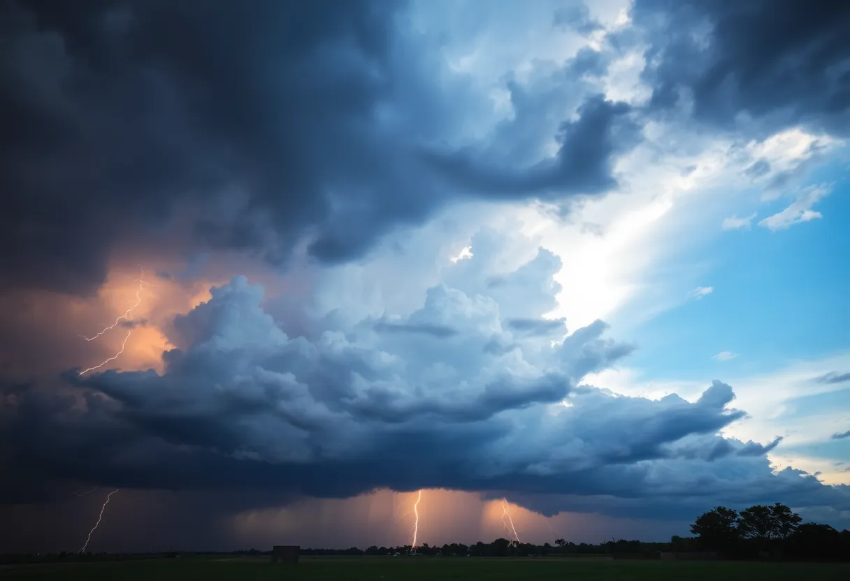
Severe Thunderstorm Warning for West and Southeast Texas
Attention, Texas residents! A round of stormy weather is on the horizon, and it’s no small matter. Late Tuesday afternoon, we are expecting some serious thunderstorms to develop east of the Texas Panhandle. These aren’t just your run-of-the-mill storms; we’re talking about supercell thunderstorms that could unleash tennis ball-sized hail. That’s right! If you thought it was a tranquil day ahead, think again!
Areas Most Likely to See Hail
Brace yourselves, residents of Wichita Falls and Abilene! You are in the crosshairs of potential hail that might exceed 2 inches in diameter. The threat is particularly high from the Red River Valley near Wichita Falls all the way down to Midland in the Texas Panhandle. It’s crucial to stay informed and prepared, as severe weather season is in full swing, especially in West Texas.
What about Southeast Texas?
If you’re in Houston, we’ve got some good news! It looks like you won’t have to worry about hail-producing storms this Tuesday and Wednesday. The frontal boundary responsible for the severe weather in West Texas seems to have other plans for now, as high atmospheric pressure will keep your area dry for the day. So, while your friends up north might be ducking for cover, you can enjoy those mid-80s temperatures with heat index values hovering around 87 degrees!
Stormy Days Ahead
What Should You Prepare For?
Continuous Storm Chances
Tornado Threat Elsewhere
Widespread Rainfall Expected
April’s Tornado Climb
Stay safe, Texas, and keep an eye on the skies!
Deeper Dive: News & Info About This Topic
HERE Resources
Houston Faces Post-Hurricane Flooding: Tropical Storm Beryl’s Impact
Houston’s Water Bills Set for Significant Increase
Severe Thunderstorms Cause Widespread Power Outages in Houston
Houston Weather Update: Cold Front Brings Showers for Easter
Weather Alert: Severe Storms Coming to Southeast Texas This Weekend
Houston Weather Update: Prepare for Severe Storms Ahead
Northeast Texas Faces Severe Thunderstorm Warnings
Severe Weather Alert: High Risk for Rip Currents and Thunderstorms in Southeast Texas
Severe Weather Hits Houston and the Rio Grande Valley
Houston Faces Record Oak Pollen Levels This March
Additional Resources
- Washington Post: Severe Storm Forecast
- Houston Chronicle: West Texas Storms
- Fox Weather: Severe Weather Outbreak
- The Weather Channel: Severe Weather Forecast
- NBC DFW: Supercell Thunderstorms Quiz
- Wikipedia: Severe Thunderstorm
- Google Search: Severe Weather Forecast
- Google Scholar: Thunderstorm Safety
- Encyclopedia Britannica: Severe Thunderstorm
- Google News: Weather Alerts