
News Summary
A cold front is expected to cause severe thunderstorms in Southeast Texas on Monday. Currently, there’s a Slight Risk for severe weather in the Brazos Valley and Piney Woods. A Severe Thunderstorm Watch is in effect until 1 AM Monday, with the possibility of hail and strong winds. While isolated thunderstorms are expected, rainfall totals may remain light. The week ahead shows warmer temperatures and chances for rain later in the week.
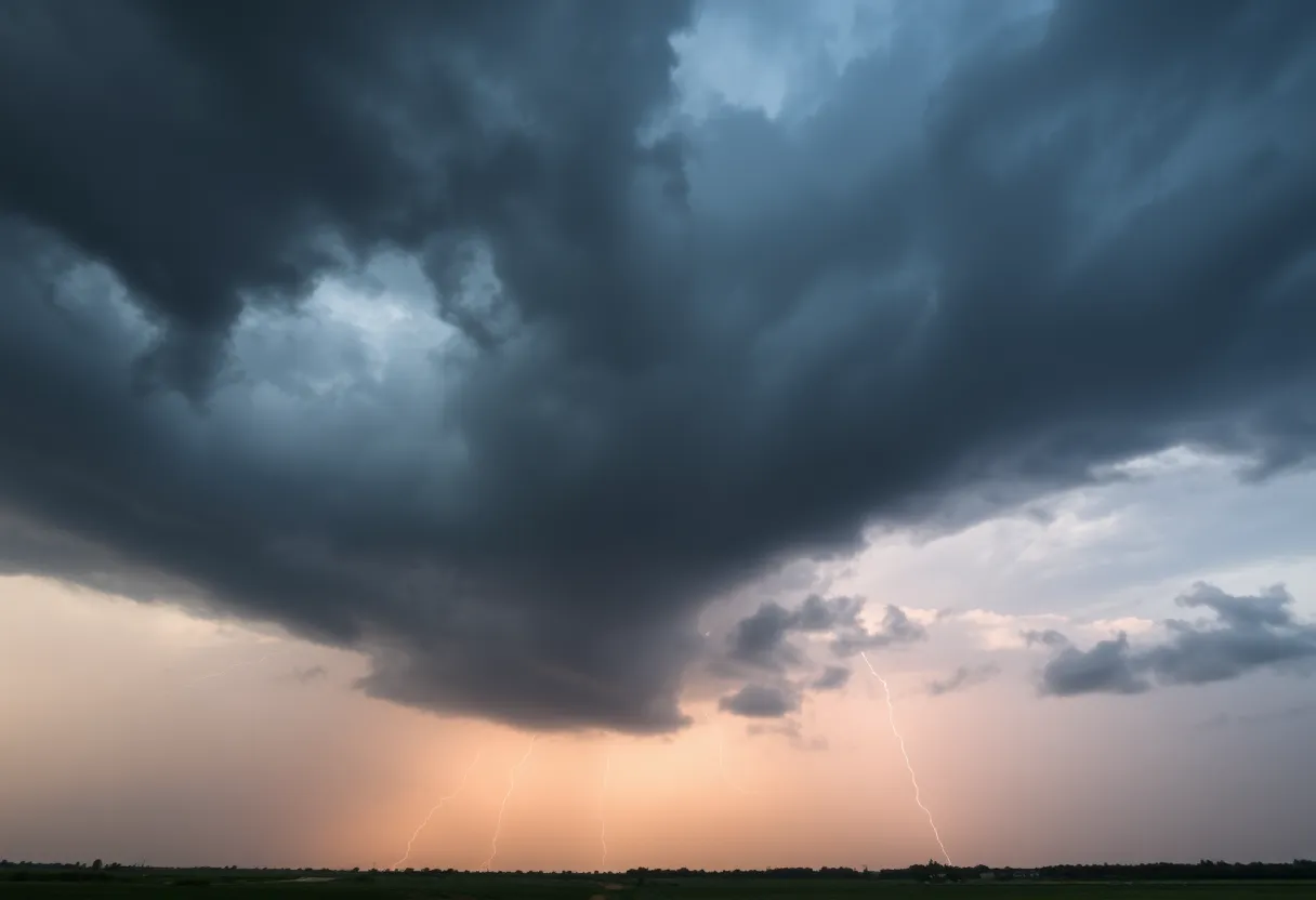
Severe Weather Alert in Southeast Texas: Thunderstorms Launch a Monday Takeover!
Hey there, Southeast Texas! Buckle up because we’ve got a wild weather ride ahead. A cold front that’s gearing up to stir things up in the Brazos Valley and Piney Woods is taking its sweet time. Instead of rolling in by late Sunday evening, it’ll now make its entrance on Monday morning. This little delay means we could be facing some serious thunderstorms that might rock the region.
What’s Happening Right Now?
Currently, there’s a Slight Risk (which is a level 2 out of 5) for severe weather stretching across parts of the Brazos Valley and Piney Woods. If you’re located south of the Brazos Valley, you’re looking at a Marginal Risk (level 1 out of 5). In layman’s terms, that means while not everyone will experience the storm drama, those who do might want to keep an eye on the sky!
Thunderstorm Warnings in Effect
Don’t forget, a Severe Thunderstorm Watch is currently in effect until 1 AM Monday for several counties, including Burleson, Brazos, Madison, Houston, Trinity, Walker, San Jacinto, Grimes, and Washington. Things are heating up in northern Brazos County and western Madison County with a Severe Thunderstorm Warning until 11:30 PM. Expect golf ball-sized hail and wind gusts threatening to reach up to 60 mph. So, if you’ve got outdoor plans, it might be time to rethink!
Weather Dynamics at Play
The reason for the delay? This cold front is moving about as fast as a sleepy tortoise. It’s slow-going because of a mix of opposing winds and warm, humid air pouring in from the Gulf – making it sluggish on its journey into Houston. Although rain is on the horizon, don’t expect torrential downpours just yet. Thanks to this sluggish system and limited moisture, rain totals in Houston are anticipated to be pretty light.
Sunday Weather Recap
Now, let’s talk about what’s been cooking on Sunday! The temperature kicked off at a mild 65 degrees this morning and could hit a pleasant high of 83 degrees by 5 PM, with gentle south winds blowing at 10-15 mph. As the afternoon rolls in, rain chances are set to ramp up to around 30% after 1 PM, and then climb to a 40% likelihood post-midnight. Be prepared for possibly isolated to scattered thunderstorms popping up by Sunday afternoon, particularly if they gain steam north of Houston.
What’s Coming Up on Monday?
Looking at the forecast for Monday, there’s a 30% chance of rain before 1 PM while we deal with cloudy skies. But don’t fret just yet! It looks like we’ll start clearing out by the afternoon, and temperatures might peak at around 84 degrees. Southeastern Texas can anticipate scattered showers and storm chances early on, but those pesky clouds are expected to bid us farewell as the day continues.
What’s Ahead for March?
For the rest of March, Southeast Texas is in for a treat with above-average temperatures expected, likely sticking around in the 80s until we venture into early April. However, keep your umbrella handy! Low atmospheric pressure systems could usher in rain showers again later in the week, particularly on Thursday and Friday when more widespread rain is on the forecast menu.
Final Thoughts
As we navigate this unpredictable weather pattern, it’s essential to stay updated on any changes. While past wildfires in the area have been quelled thanks to returning moisture, keep in mind those same warm southerly winds are now stirring the pot for potential severe weather. So, keep an eye to the sky, stay safe, and let’s weather this storm together!
Deeper Dive: News & Info About This Topic
HERE Resources
Texas Battles Drought as Houston’s Pollen Surges
Houston Welcomes Spring with Unseasonably Cool Temperatures
Houston Weather Update: Warmth and Chilly Nights Ahead!
Additional Resources
- Houston Chronicle: Sunday Weather Forecast
- Click2Houston: Slow Front Delays Storms
- Fox26 Houston: Storms & Rain Sunday
- CW39: Severe Storm Threat in North Texas
- Wikipedia: Thunderstorm