
News Summary
Residents of Northeast Texas are being warned of severe thunderstorms this Sunday. Areas like Texarkana, Longview, and Nacogdoches could see large hail and isolated tornadoes. The Storm Prediction Center has rated the risk as Level 3 out of 5. Storms are expected to develop between 5 p.m. and 10 p.m., with a chance of less severe weather in Houston. Prepare for changing weather conditions over the next few days, including the potential for rain and cooler temperatures next week.
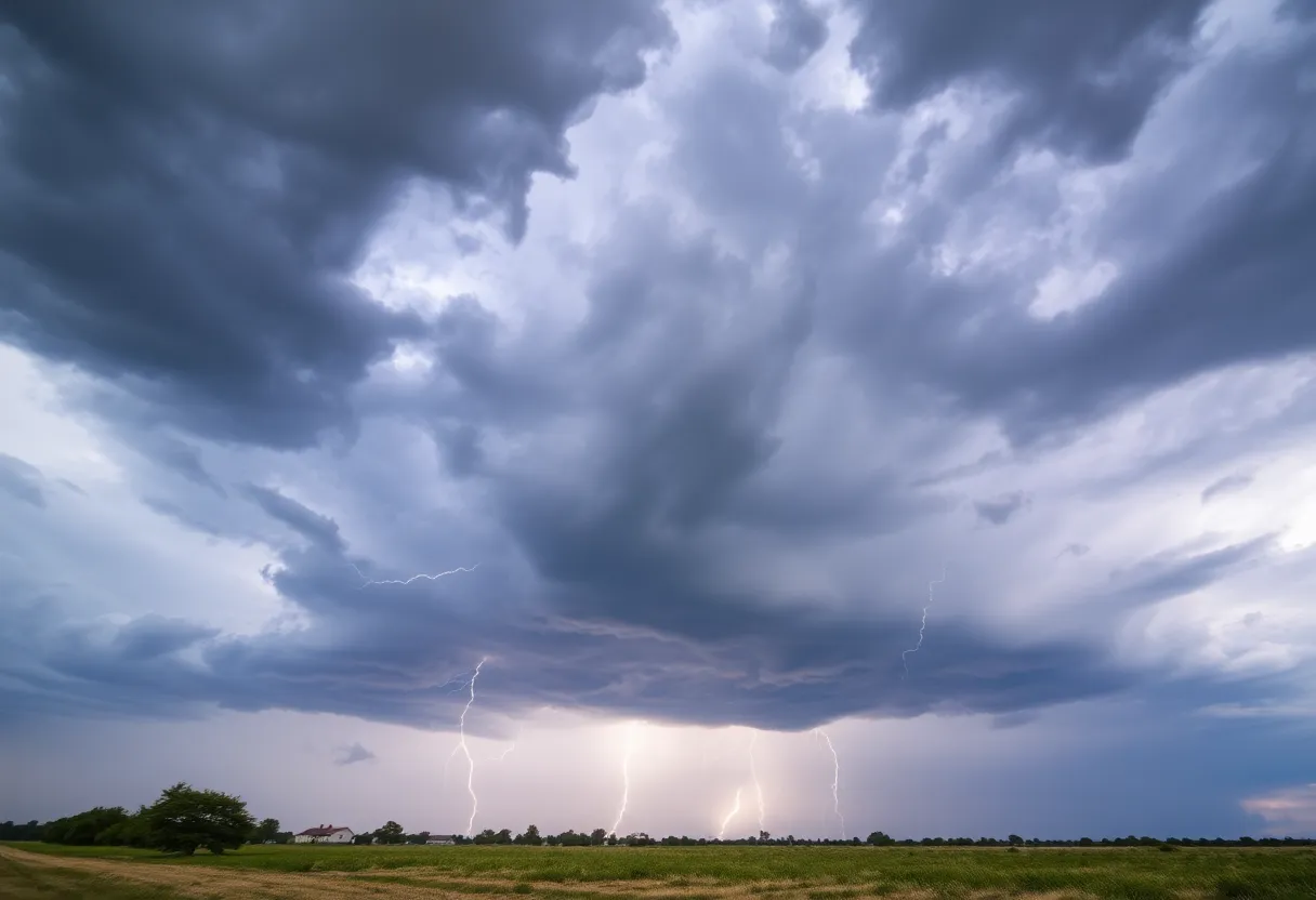
Northeast Texas Brace for Severe Thunderstorms: Tornadoes Possible!
Attention residents of Texarkana, Longview, and Nacogdoches! Get ready to keep an eye on the skies because severe thunderstorms are making their way to your area this Sunday afternoon and evening. Sounds dramatic, right? That’s because it is! A weak cold front is sliding southward, and when it meets up with the warm, humid air hanging around, you can expect some stormy weather on the horizon.
What to Expect
These storms could bring with them more than just rain. Think large hail and the possibility of isolated tornadoes. Yikes! The Storm Prediction Center has classified much of Northeast Texas at a Level 3 out of 5 risk for severe storms. So, if you’re in those cities like Texarkana, Longview, and Nacogdoches, it’s especially important to take this seriously. Prepare your family, your home, and stay tuned to updates.
Now, if you’re living north of Interstate 10, you might want to buckle up, as this is where the worst of the weather is expected. But don’t breathe a sigh of relief too quickly if you’re a bit farther south. The Piney Woods area, which includes towns like Crockett, Lufkin, Huntsville, and Livingston, is under a Level 2 out of 5 risk.
Timing is Everything
The prime time for these storms to pop up will be between 5 p.m. and 10 p.m. on Sunday. If you’re planning any outdoor activities, it might be wise to revise your plans. While the Piney Woods is not expected to see as many storms compared to the northeast, those that do develop could really ramp up quickly. So be prepared!
The Houston Area
If you’re in Houston, the storm risk is quite a bit lower—a Level 1 out of 5 risk indicates that storms may have a rough time actually taking shape. Overall, the chances are sitting at about 20%. It won’t be all gloomy, though. You can expect warm and muggy conditions with morning lows around 70°F and highs creeping into the low 80s. Sounds like typical Texan weather!
Looking Ahead
As we move into Monday, temperatures will still hover around above-average. Morning lows will be near 70°F, with daytime highs reaching the mid-80s. Don’t get too comfortable, as a weak cold front will come through Southeast Texas on Monday evening. This could lead to a slight temperature drop by Tuesday—only a few degrees, mind you.
By Tuesday, you can expect morning lows in the mid-60s with afternoon highs hitting the low 80s. But hold onto your hats—if you’re hoping for a break from the heat, mid-week forecasts show highs climbing back up to between 87°F and 89°F in Houston.
Rain on the Horizon
And let’s not forget about the potential for rain! Isolated showers or storms could pop up late Wednesday into Thursday, but again, the best chances will likely stay north of I-20. As we roll into next weekend, there’s word of a broad low-pressure system that might surprise us with widespread showers and thunderstorms, possibly bringing along some heavy rainfall. But exactly when and how much? That’s still up in the air.
So here’s your takeaway: Stay aware, stay safe, and keep your eye on the weather updates over the next few days. Northeast Texas has some stormy weather coming its way, and with a little preparation, you can ride it out with ease!
Deeper Dive: News & Info About This Topic
HERE Resources
Severe Weather Alert: High Risk for Rip Currents and Thunderstorms in Southeast Texas
Additional Resources
- AP News: Texas Flooding and Thunderstorms
- Express News: Texas Severe Storms Forecast
- CBS News: North Texas Weather Update
- Fox Weather: Weekend Severe Weather Outlook
- Reuters: Severe Storms in Texas-Mexico Border
- Wikipedia: Severe Weather
- Google Search: Texas Weather Update
- Google Scholar: Texas Severe Storms
- Encyclopedia Britannica: Severe Weather
- Google News: Texas Storms